*URGENT MESSAGE*
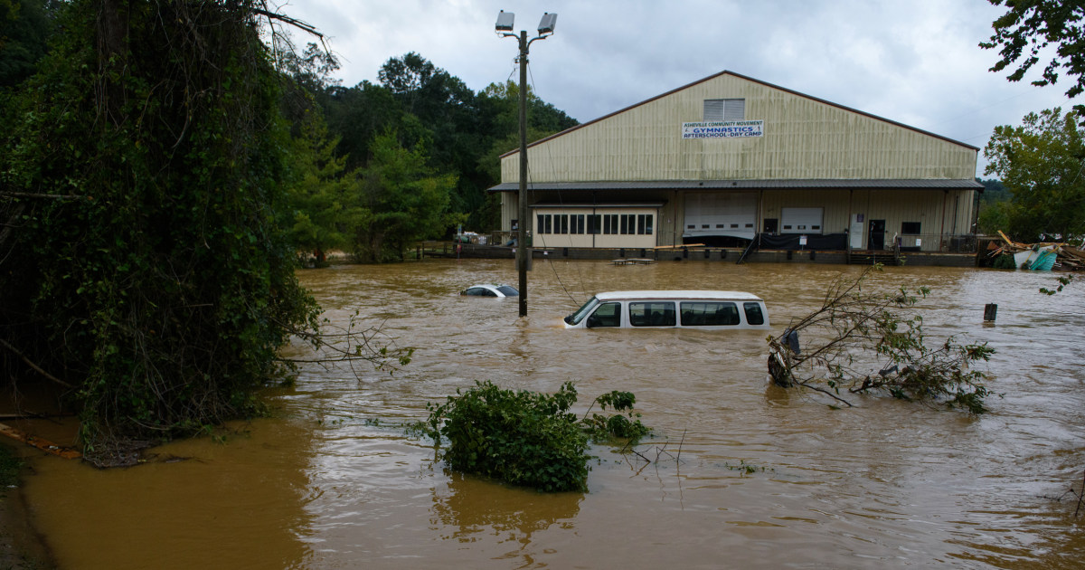
This will be one of the most significant weather events to happen in the western portions of the area in the modern era. Record flooding is forecasted and has been compared to the floods of 1916 in the Asheville area. The impacts from this event are expected to be greater than Tropical Storm Fred from August 2021, the mountains in 2004 from Frances and Ivan, and in Upstate South Carolina the Saluda River Basin flooding from 1949. We plead with everyone that you take every single weather warning very seriously through the entirety of this event as impacts will be life-threatening and make sure to have multiple ways to receive the alerts. The protection of life and property is the overall mission of the National Weather Service, and we pledge to stand by the folks of the western Carolinas and northeast Georgia. We cannot stress the significance of this event enough. Heed all evacuation orders from your local Emergency Managers and go to a storm shelter if you do not feel safe at your current location.
Hurricane Helene will make landfall later this evening near the Big Bend of Florida. Significant to catastrophic, life-threatening flooding will occur along and near the Blue Ridge Escarpment. Historic flooding will be possible in this area as an additional 9-14" of rainfall will be in store. Many landslides will occur as a result, with a few large and severely damaging slope failures or debris flows are likely.
Possible hurricane-force gusts in the North Carolina mountains, northeast Georgia, and the western portion of Upstate South Carolina. 60-70 mph wind gusts possible elsewhere. The combination of strong winds and super saturated soils will lead to widespread trees down and numerous power outages.


