Hurricane Season 2020

AndyMarquisLive

I love short track racing (Taylor's Version)
Joined
Feb 16, 2009
Messages
85,279
Points
1,033
Location
A short track somewhere
I didn't even want to think about what a hurricane season would be like in 2020, but we've got a nice, early start. :rolleyes:

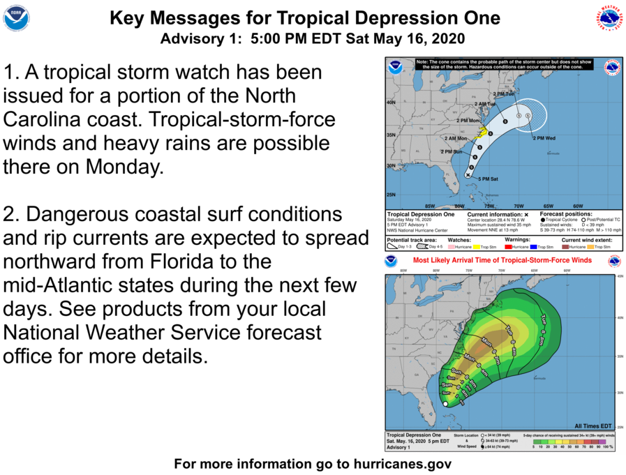
212653_key_messages_sm.png
 
Texas is currently experiencing a tropical storm.

Officially barometer is currently 1002 mb in the "eye" but some stations have dropped below 1000 unofficially.

97454894_10213493595092992_4444978323122028544_n.jpg


We have a strong low formed up over east Texas. 998 mb low. Basically a ground based tropical storm.

Tornadoes, and high winds moving between i 35, and Tennessee will be possible the whole way. This will be extremely isolated because the low does not have much moisture to fuel it. Some risk will remain between Waco Texas, and Nashville Tennessee. Including portions of East Texas, Southern Oklahoma, Southern Arkansas, northern Louisiana, and central Mississippi.
 
On the second day of the 2020 hurricane season, we have a tropical storm. Third one in three weeks. The last two have impacted the United States with significant flooding (Arthur in Eastern NC, Bertha in SC).

 
Because it's 2020, things are not going well.

Hurricane Hanna made landfall in the month of July in Texas. Yes, this is putting us right on the brink of surpassing 2005 in terms of named storms, but not intensity. That said, the data regarding this tropical wave in the Caribbean is looking very bad for us in North Carolina. Because it's 2020.
 
Sigh.

ZCZC MIATWOAT ALL
TTAA00 KNHC DDHHMM

Tropical Weather Outlook
NWS National Hurricane Center Miami FL
800 PM EDT Mon Jul 27 2020

For the North Atlantic...Caribbean Sea and the Gulf of Mexico:

1. Shower activity associated with a low pressure area located about
850 miles east of the Windward Islands has again become a little
better organized, however the low's circulation remains broad
without a well-defined center of circulation. Environmental
conditions are expected to become somewhat more conducive for
development, and a tropical depression or tropical storm is likely
to form during the next couple of days while the system moves
west-northwestward at 15 to 20 mph and approaches the Leeward
Islands. Regardless of development, locally heavy rains and gusty
winds are likely across portions of the Leeward Islands on Wednesday
and will spread westward to the Virgin Islands and Puerto Rico
Wednesday night and Thursday. Interests on these islands should
continue to monitor the progress of this system, and tropical storm
watches or warnings could be required for portions of the area on
Tuesday.
* Formation chance through 48 hours...high...70 percent.
* Formation chance through 5 days...high...80 percent.

Forecaster Berg
 
Tuned up the generator, prepped the house, and in a couple of weeks, prep for winter.
The time is now, when the weather is somewhat favorable.. This heat isn't the problem for me, it's the humidity. It's like breathing water..
And , getting a new roof makeover, 2nd week of August. I'll have plenty of ice water for those hardworking souls....
 
Looks like Hatteras is gonna get a blow, fishing will pick up after it leaves. Truck and tackle are ready, it's been a slow fishing spell!
 
This storm didn't weaken at all over Hispaniola.

Looks like Hatteras is gonna get a blow, fishing will pick up after it leaves. Truck and tackle are ready, it's been a slow fishing spell!

Looks like we're gonna get hammered down here in Carteret County as well. Guess I'm hurricane supply shopping tonight.
 
I'm in Pasquotank county, in the middle of a bean field and it's hot as a four balled tomcat....
 
I'm in Pasquotank county, in the middle of a bean field and it's hot as a four balled tomcat....

You and I are both fixing to get rekt. It looks like it's going to make landfall right around Topsail, which means we'll get the Northeast quadrant of the storm which is usually the worst.
 
Good news is that track is east. There's a chance this might miss us. Though the EURO is still hellbent on us getting a direct hit with ground level wind gusts of 125 mph.
 
Just hope it doesn't get any stronger. The folks on Ocracoke do not need this, they were devastated by Dorian....
 
Just hope it doesn't get any stronger. The folks on Ocracoke do not need this, they were devastated by Dorian....

Yep. That was a bad hit. We're still recovering from Florence here.

Storm weakened a bit and is fighting wind shear but looks like it's winning that fight. I'm not worried about a cat. 1, but those ocean temperatures are very warm.
 
The latest model runs have the storm hitting Florida now, which would be very good for us in North Carolina.

It's actually possible that we don't get any rain from this at all. That'd be unfortunate, we do NEED rain, BAD. Hasn't rained a drip here in over a month.
 
Looks like it will be a fast moving storm, that's good. Sunday evening we'll know a whole lot more. We've had rain every week, cutting the grass every 4 or 5 days....
 
We now have Hurricane Isaias again, just before landfall which is looking like it'll be anywhere between Myrtle Beach and Wilmington.
 
Am I the only one that wants to see Jim Cantore just disappear....
To me, he is just ingrating....
 
Same here, dodged some tornadoes and picked up twigs mostly. Bertie county got it bad....
 
Day 2 of generator assistance. Whole house, automatic transfer, propane powered. Fortunately, I had the foresight years ago to put a 2 bottle system in, similar to my camper. When one missile is drained, switch over and refill the empty. The usual tree debris , but nothing major..​
And, Friday, the roofer will be here @ 7am. All weekend for a complete roof rehab .Should be an interesting couple of days...
This was my neighbor; poor guy...
Screenshot_20200805-223222_Messages.jpg
Screenshot_20200805-223228_Messages.jpg
 
I mowed today, figuring that inches of rain might be a guarantee. Maybe i should have dropped the blade box one notch further down.
 
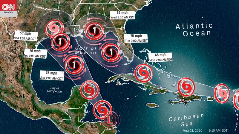
NOLA might get partially saved depending on how they co-habitate the gulf. Normally #14 would push water into NOLA, but then Laura will be pulling water away from the coast. So it might balance.
 
And, now the forecast track for Marco has changed --- drastically.
Looks like no rain for the Hill Country.
I jinxed it. :(

But based on today's 4PM tracks, Anybody in NOLA oughta start leaving now.

Dad got an email from Lowes, they are pushing lumber products, batteries, and emergency lighting....
 
I'm gonna get a good chunk of Laura(I stay in the middle of southern Louisiana) plus I have a lot of family that stays in the Port Arthur-Beaumont area. Needless to say this one has me very worried.
 
I'm in the Galveston TX area now delivering to a customer. Going to spend the next couple days in Pasadena TX albeit not by choice. I'll be pretty much out of service hours by the time I'm done offloading and make it back to the terminal to drop off this empty.


Screenshot_20200826-100726~2.png
 
I hope all of our Texas posters stay safe! Laura is going to pack a punch.

 
Back
Top Bottom