HoneyBadger
Big Amber Glenn Fan
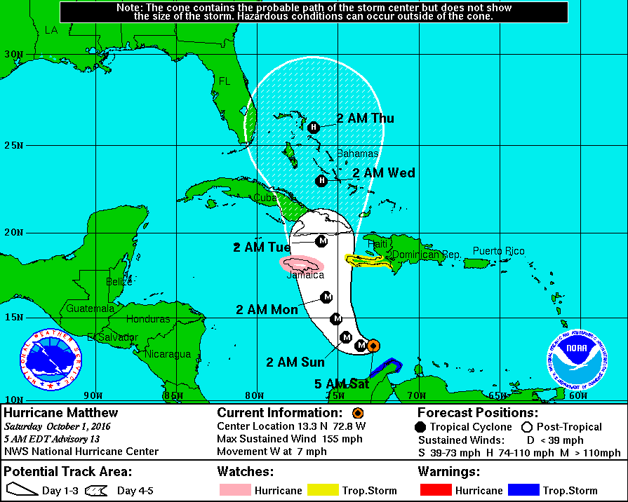
While some of y'all are enjoying fall, some of us are watching the tropics for Hurricane Matthew. Right now, it's a category five NOPE!


Cape Hatteras is about to get ******... Again.
I live in Swansboro. We're about to get REKT.
Be safe dude. Get all the milk and eggs right now before the rain comes.
If it looks like we're gonna get f*****, I'm not sticking around for it.
Dirt --- stay safe. Bug out early and don't delay.Latest models show it going just about right over Hampton Roads (aka, me.) Not looking forward to this sh!t.
Latest models show it going just about right over Hampton Roads (aka, me.) Not looking forward to this sh!t.
Latest models show it going just about right over Hampton Roads (aka, me.) Not looking forward to this sh!t.
Now the NHC is saying it just might sit off the Carolina coasts for a couple of days.
http://www.nhc.noaa.gov/refresh/graphics_at4 shtml/093327.shtml?5-daynl#contents
But, it's still to early to say for certain. These things are so unpredictable.
That cone of uncertainty can get larger or turn in a few hours.

Here down in Miami..likewise, stay safe...I'm just between Jacksonville and Gainesville, they are preparing for the worst around here. Hopefully it will break up some before it hits us. You be safe everyone, stay off the roads if you can.
Looks like we're going to dodge a bullet. Still gonna get a lot of rain and wind, but it's not going to be the catastrophic event they were calling for 24 hours ago.
I'm glad I stocked up on supplies though. That thing could still decide to **** us.
The shift to the East is a good thing.
But the European computer model disagrees with the GFS and NHC forecast. It has the hurricane just off the coast of Wilmington before the shift East.
I've been watching closely. Forecast says it's going to rain from Thursday through Sunday, with tropical storm conditions Friday, Saturday and Sunday. If the NHC forecast brings Matthew closer to Wilmington, Jacksonville and Morehead, that's the difference between four inches of rain and 40 mph winds and 18 inches of rain and 80 mph winds.
Other thing that sucks is the way its going to loop around and hit again. The European model already has the storm hitting North Carolina on its second pass next weekend.
Are we even sure it's going to loop back yet? I thought that was still just a possibility.Yeah, we are prepped over here. We are further inland, but it can still affect us here in Polk. I'm concerned about after the fact where it loops back because it could really cause an issue here in Florida.
This could be similar to what Andrew did back in '92.
